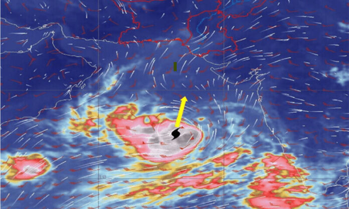
ISLAMABAD: The government on Friday advised authorities in Sindh and Balochistan to remain alert as a “very strong” cyclonic storm, Biparjoy, over the Arabian Sea was reported to be moving towards Pakistan’s coastal areas.
According to an advisory issued by the Pakistan Meteorological Department (PMD), Cyclone Biparjoy had changed its course and slowly tracked in the north-northeast direction during the past 12 hours.
It now lies near latitude 14.8°N and longitude 66.5°E at a distance of about 1,120km south of Karachi.
“Maximum sustained surface winds are 130-150km/hour gusts and 160km/hour around the system centre.”
The advisory highlighted that the favourable environmental conditions including the sea surface temperature of 30-32°C, low vertical wind shear and upper-level divergence were still supporting the system to intensify further.
“Owing to the shift in upper-level steering winds, there is an uncertainty in the global model’s opinion regarding the track forecast of Biparjoy with some taking it to Oman-Pakistan western coast and others indicating towards Indian Gujarat-Pakistan Sindh coast”.
“Considering this uncertainty, the system is likely to keep tracking further north/northeastward during the next two days,” the Met Office added.
Outlining the possible impacts of the cyclone, it advised fishermen not to venture into the open sea from Monday, June 12 until the system was over as the sea conditions might get rough accompanied by high tides along the coast.
“With its probable northeast track, the rain-thunderstorm with some heavy falls and squally winds are expected on the Sindh-Makran coast from June 13 night to June 14 morning,” the advisory added.
Meanwhile, Minister for Climate Change Sherry Rehman has alerted authorities.
“All relevant authorities, particularly PDMA Sindh and Balochistan, are advised to take stock of preparations and ensure public safety for communities in coastal areas,” she tweeted.
A day earlier, Chief Meteorologist Sardar Sarfaraz had told media that the system was far away from the coastal areas of Pakistan.
“It’s likely to move further in the north-northwest direction. Sea conditions are very high around the system centre with maximum wave height 25-28 feet,” he said.
“If the distance (between the cyclone and the city) reduces to 600km, we may experience high clouds. The system is likely to take four days to reach Oman and then it may influence weather conditions in the coastal areas of Balochistan,” Sarfaraz added.


