BEIJING: Chinese emergency authorities deployed an array of satellites, including Fengyun meteorological satellites, to support rescue efforts after the recent dike breach at central China’s Dongting Lake.
A burst dike in Tuanzhou Township, Huarong County under Hunan Province’s Yueyang City triggered flooding in the area on July 5. Thousands of rescuers, including firefighters, hydrologists, volunteers and police, worked tirelessly to safeguard lives and properties.
Fengyun satellites provided real-time monitoring of precipitation in the affected area and upstream regions, offering crucial information to support emergency rescue efforts, said the satellite’s developer on Saturday.
Shanghai Academy of Spaceflight Technology (SACT), a subsidiary of China Aerospace Science and Technology Corporation (CASC), said the Fengyun satellites, or FY satellites, sprang into action to aid relief efforts following the disaster at Dongting Lake, the country’s second-largest freshwater lake.
Advanced instruments like the Geosynchronous High-speed Imager (GHI) of the Fengyun-4B satellite and the Medium Resolution Spectral Imager (MERSI-III) of the Fengyun-3F satellite were utilized to closely track weather changes in the affected area. This vital information was then relayed to relevant units to support disaster relief work.
Beyond real-time monitoring data, Fengyun satellites provided a wealth of additional information. This included cloud maps, cloud height and temperature products, cloud phase data, precipitation estimates and detection products. This comprehensive data set significantly bolstered meteorological forecasting services in the disaster zone.
Fengyun satellites, currently comprising two integrated observation systems of polar orbit and geostationary satellites, are capable of generating hundreds of satellite products encompassing atmospheric, land, ocean and space. SACT says it is committed to further enhancing the observation capabilities of Fengyun satellites, solidifying their role as a crucial outpost in building a robust first line of defense for preventing and mitigating meteorological disasters.
In addition, several other satellites, including Gaofen-3 02, Gaofen-3 03, Gaofen-1, and Gaofen-4, were deployed to provide real-time observation of the affected areas as well, according to the China Center For Resources Satellite Data and Application (CRESDA).
The relief efforts were further bolstered by commercial satellite companies. Chang Guang Satellite Technology Co., Ltd. deployed its Jilin-1 Kuanfu 01A satellite, capturing high-resolution images shortly after the dike breach. These images revealed a significant widening of the breach and extensive flooding compared to previous observations.
Other commercial players also joined the mission. Smart Satellite Technology Co., Ltd. utilized its SmartSat-X1 satellite to gather detailed data on the disaster zone. Additionally, Beijing Minospace Technology Co., Ltd. activated its Taijing-4 01 and Taijing-4 03 satellites to contribute to the relief efforts.

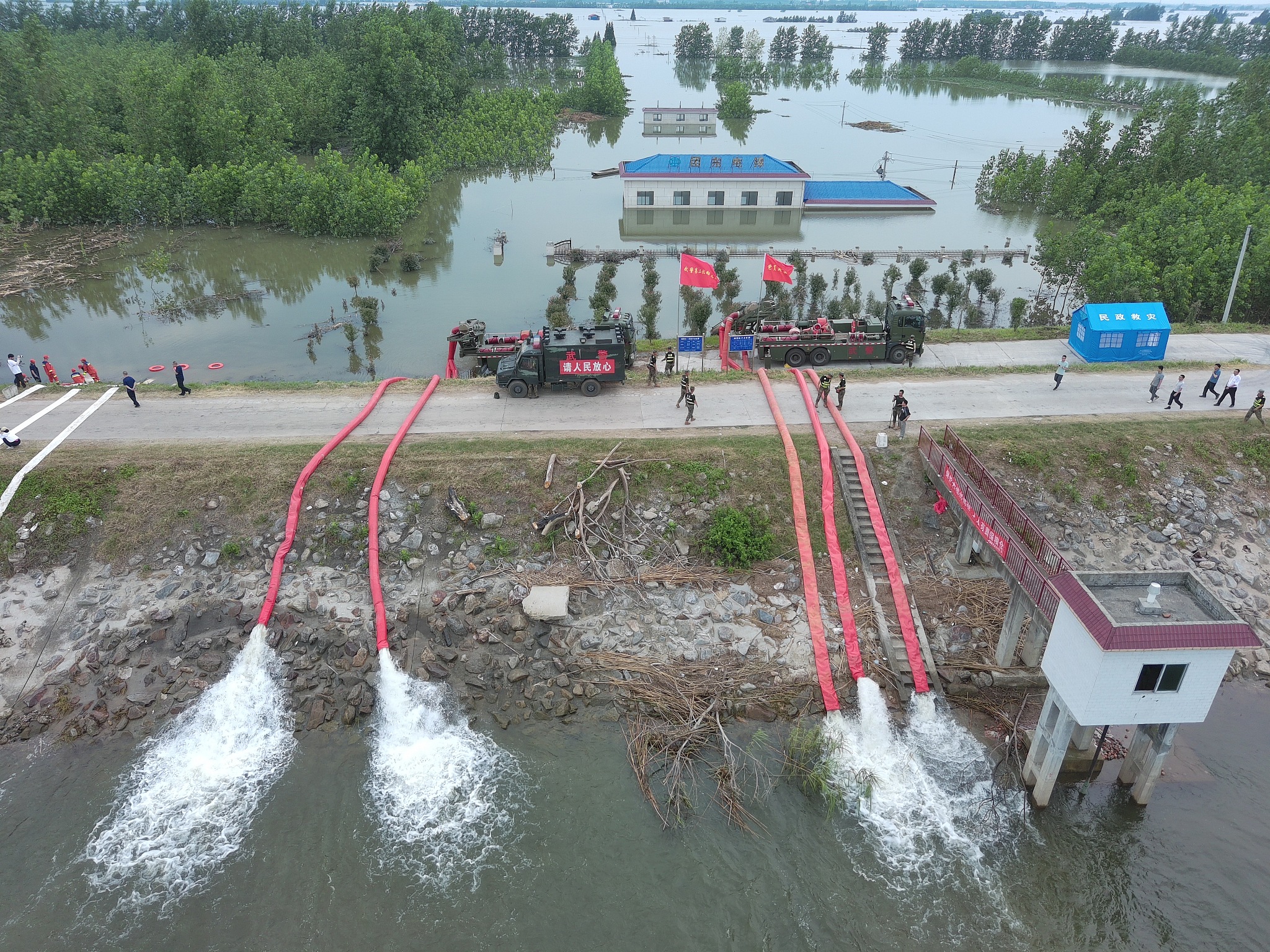
Rescuers work on an embankment to stem the piping effect in Huarong County, central China’s Hunan Province, July 10, 2024. /CFP
Dongting Lake has historically faced flood challenges. Hunan Province has endured its heaviest rainfall of the year since June 16, surpassing records in some localities.
The breach in Dongting Lake’s embankment at Tuanzhouwan was sealed by 10:30 p.m. on July 8. By 6:00 a.m on July 10, the water levels at Yueyang Station, the last one above the warning level, receded below the 32.5-meter threshold and continued to fall. Post-disaster efforts like facility maintenance and drainage are underway in a well-coordinated and intensive manner.
While Dongting Lake water levels have receded below the danger zone, past flood control experiences highlight the potential for unforeseen challenges during the water withdrawal period. Therefore, relevant regions and departments must remain vigilant. To ensure the safe and orderly progression of post-disaster work, SACT confirmed Fengyun satellites will continue close monitoring of precipitation in Dongting Lake and upstream areas.


